


27. April 2002
Arrival in Menorca
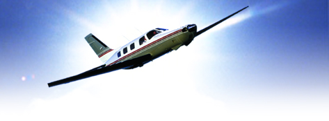
All members / friends of the Africa 2002 Trip will fly in to Menorca airport on
April, 27. 2002 between 12:00 – 14:00 UTC. Everybody takes own transportation (taxi) to the nearby Hotel.
Reception will take place at 19:00 local (17:00 UTC) in the Hotel.
Will have all the time to get familiar, talk about the trip, e.t.c.
Menorca is just 35 miles long and miles wide with few mostly laid back beach resorts and around 120 beaches, coves, bays, and harbours around the rocky coastline. There are several excellent prehistoric sites and places of historic interest, including grand Menorcan country farmhouses.
28. April 2002
Depature Menorca for Tamanrasset (Algier)
• with a stop in Ghardaia for refueling
2 nights in the area of Tamanrasset
Meet the Tuareg!
2 nights in an original Tuareg tent (full board) (You have to
bring your own sleeping bag)
½ day excursion into the Hoggar mountains
Tamanrasset Arabic: tamanghasit
City in Algeria with 40,000 inhabitants.
Tamanrasset is situated in the Sahara desert at an elevation of 1,400 metres in the Hoggar Mountains.
The economical base of Tamanrasset is trade for central Sahara, where it is by far the largest city. There is some agricultural output from the region as well, of which much is sold at the markets of Tamanrasset.
A large number of the people living in the city now are drought
refugees from large areas in the Sahara.
30. April 2002
Depature Tamanrasset for Timbuktu /
Tombouctou (Mali)
• with a stop in Gao for refueling
1 night in Tombouctou Hotel Azelai (***star)
Exploring Mali | Africa Homepage
Mali is a nation of unusual interest and charm. Like Egypt, Mali is a country that is intimately related to a great river-in this case, the Niger. In addition, Mali is the location of some of the continent's most interesting cultural sites.
Legendary Timbuktu is located here, and in the center of the country is the magnificently dramatic Bandiagara escarpment, home to the fascinating culture of the Dogon.
Location, Geography & Climate
Mali, the largest country in West Africa, is bordered by seven other states: Algeria lies to the north and northeast, Niger to the east, Burkina Faso to the southeast and, with the Ivory Coast, to the south. On the west are Senegal and Mauritania. Mali is shaped a bit like a butterfly, leaning to the northwest, with a much smaller left than right wing. The larger northwestern region of the country, which extends into the Sahara, is almost entirely arid desert or semidesert. In the central region, known as the Sahel, life follows the Niger River's annual flood cycle, with high water between August and November. In the southwestern area, rainfall and rivers are more plentiful, and this region is marginally more lush than the rest of the country. Mali's single most important geographic feature is undoubtedly the great Niger River, which traverses both the Sahel and the southeastern section of the country. The Niger, like the Nile, is both a critical source of sustenance and a major transportation artery--and in this latter capacity it is an excellent venue for boat travel. Although most of Mali experiences only negligible rainfall, the 'rainy' season in the south extends from June through September.
History & People
Although Mali is today one of the poorest countries in the world, it has a long and illustrious past as an integral part of great African empires. The first of these empires was the empire of Ghana, which from the 4th to the 11th century controlled the trans-Saharan caravan routes. Ghana fell under invasions by the Muslim Almoravids, but it was soon supplanted by a the Mandinka empire of Mali. Mali reached its pinnacle of power and wealth during the 14th century, extending over almost all of West Africa and controlling virtually all of the rich trans-Saharan gold trade. It was during this period that Mali's great cities, Timbuktu and Djenne, became fabled centers of wealth, learning, and culture. Mali's power didn't last much longer. In the 15th century it fell to the Songhai, who had established their own capital at Gao. The Songhai held sway until the end of the 16th century, their empire collapsed under both internal and external pressures. The end of the Songhai empire also marked the conclusion of the regions history as a trading centre, for the trans-Saharan trade routes quickly lost their vitality after the establishment of sea routes by Europeans.
In the late nineteenth century, Mali became a French colony, and in 1960 it became independent. The country has suffered from periods of internal and external strife, as well as from an extended drought in the early 1970s, but today it appears to by moving toward a stable, multi-party democratic government. Mali's population comprises a number of different peoples, including the Bambara (who are the largest single segment), the Songhai, Mandinka, Senoufo, Fula, and Dogon. The last of these groups, the Dogon, are world-renowned for their artwork, and a visit to their traditional cliffside villages is a fascinating experience. The majority of Mali's people are Muslim, and the official language is French. Bambara, however, is the country's true lingua franca.
Timbuktu or Tombouctou, city, central Mali, on the southern edge of the Sahara, just north of the great bend of the Niger River. It is connected with the Niger by canals and is served by the small river port of Kabara. The city is a regional trade center for salt and other basic commodities. Its few manufactures include cotton textiles, leather goods, and pottery.
© MMIG46 e.V.